The morning light reflects off the slow-moving surface of the Ottawa River, where small waves lap against the stone embankments near the locks. A low rumble of wheels on pavement mixes with the occasional call of gulls overhead, while the scent of damp earth rises from the nearby parkland after an overnight rain. Pedestrians cross at marked intersections as vehicles proceed along Wellington Street, their progress measured and steady rather than hurried.
This ordered movement through the city depends on several coordinated public systems. International visitors benefit from understanding the main options before setting out, particularly when distances between Parliament Hill, museums, and residential areas exceed comfortable walking range.
| Mode | Single fare | Notes |
|---|---|---|
| Confederation Line (light rail) | $3.70 | Transfers to buses within 90 minutes |
| OC Transpo bus | $3.70 | Day pass $8.50, valid until 2 a.m. |
| STO bus (Gatineau side) | $3.70 | Separate transfer required to OC Transpo |
| Taxi from airport | Metered/flat fare varies | Check current rates with the dispatcher on arrival |
| Ride-share | Metered/quoted | Surge pricing at weekday peaks |
Confederation Line light rail
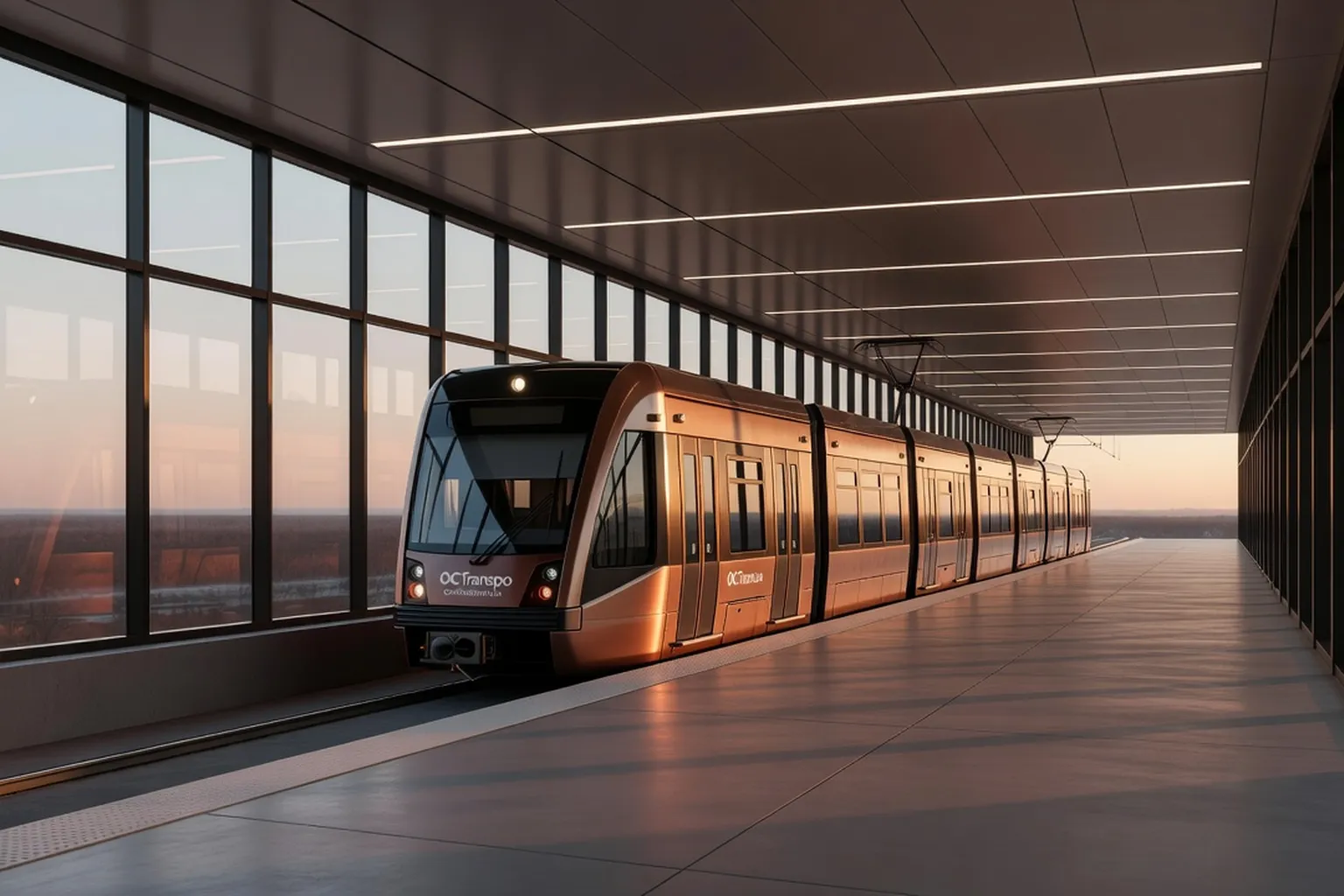
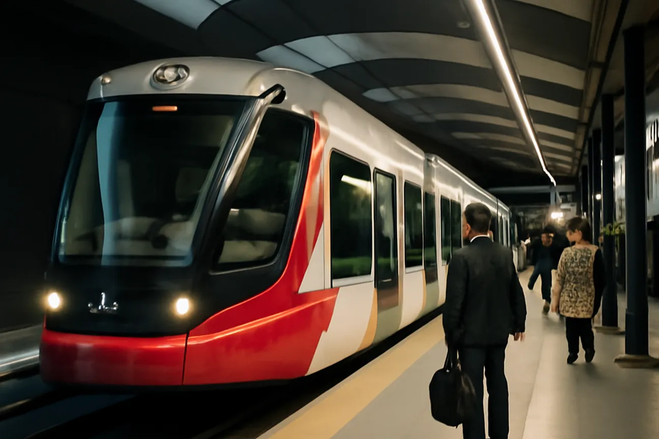
The Confederation Line forms the backbone of Ottawa’s east-west rail service. Opened in September 2019, the route runs 12.5 kilometres from Tunney’s Pasture in the west to Blair station in the east, passing through 13 stations with a mix of underground and surface sections. The line connects directly with the Ottawa station served by Via Rail, allowing passengers arriving by intercity train to transfer without additional surface travel in most cases.
Service begins at approximately 5:00 a.m. on weekdays and continues until shortly after midnight, with headways of four to six minutes during peak periods and eight to ten minutes at other times. Weekend schedules start later and maintain ten-minute intervals for most of the day. Each train consists of two coupled vehicles with capacity for roughly 300 passengers, including designated spaces for bicycles and wheelchairs. Real-time arrival information appears on platform screens and through the OC Transpo mobile application.
Fares are integrated with the broader OC Transpo network. A single adult ticket purchased from station machines costs 3.70 Canadian dollars and permits transfers to buses within 90 minutes. Monthly passes and day passes are also available through the same machines or the Presto card system. Visitors staying several days often find the Presto card convenient, as it reduces the per-ride cost after the initial loading fee. Luggage storage is limited; large suitcases must be kept clear of aisles during busy periods.
Stations such as Rideau and Parliament provide the most immediate access to central attractions, including the grounds covered in our Parliament Hill field guide, while Lyon station serves the western end of downtown. From Blair, onward connections to Orleans neighbourhoods rely on feeder buses rather than continued rail service at present. The system does not extend to the airport; travellers arriving by air must use a separate bus route from the terminal. Maintenance closures occur on occasional weekends for track inspection, with replacement buses posted in advance on station notice boards.
OC Transpo buses
OC Transpo operates the surface bus network that fills gaps left by the rail line and serves neighbourhoods beyond the Confederation Line corridor. More than 170 routes cover the city, ranging from frequent local services to limited-stop express routes that operate during weekday rush hours. Many routes converge at major transfer points such as Hurdman, Lincoln Fields, and St-Laurent stations, where passengers can move between buses or reach the light rail platforms without leaving the paid area.
Buses run from roughly 5:00 a.m. to 1:00 a.m. on most corridors, though some suburban routes end earlier. Peak-hour frequency on trunk routes reaches every five to eight minutes, while off-peak service extends to fifteen or twenty minutes. Exact schedules appear at stops and within the OC Transpo application, which also issues service alerts for detours caused by construction or weather. Winter operations include the use of articulated buses on high-demand corridors and additional vehicles deployed on short notice when heavy snowfall is forecast.
Payment follows the same fare structure as the rail line, with transfers valid across both modes. Passengers board at the front and tap Presto cards or show paper tickets to the driver. Several routes accept contactless credit cards for single fares. Route 97 provides a direct link from the airport to downtown stations, taking approximately thirty-five minutes under normal traffic conditions. Route 6 travels along the Rideau Canal and serves the University of Ottawa campus area.
Visitors planning multiple trips within a single day can purchase a day pass for 8.50 Canadian dollars, valid until 2:00 a.m. the following morning. Seating priority is given to older passengers and those with mobility aids; standing passengers are expected to hold handrails during movement. Bicycle racks are fitted to the front of most buses, though capacity is restricted to two bicycles per vehicle and not available on express routes during peak hours.
STO buses across the river
The Société de transport de l’Outaouais, commonly abbreviated STO, manages bus service on the Quebec side of the Ottawa River. Its routes connect Gatineau districts with Ottawa via the Macdonald-Cartier, Portage, and Alexandra bridges. Service runs from early morning until after midnight on weekdays, with reduced frequency on weekends. Headways average ten to fifteen minutes on principal corridors such as routes 21, 31, and 59 during daytime hours.
Fares differ from the OC Transpo system. An adult single ticket costs 3.70 Canadian dollars when purchased aboard or from ticket machines at certain stops. Day passes and monthly cards are offered, yet transfers to OC Transpo vehicles require a separate purchase unless a special interprovincial pass has been obtained in advance. Many STO buses accept Presto cards for payment, though the stored value remains separate from Ottawa accounts.
Key stops in Ottawa include those near the Canadian Museum of History and along Wellington Street, close to the locks described in our Rideau Canal field guide, where passengers disembark for Parliament Hill. From Gatineau, route 85 links the Museum of Civilization area with downtown Ottawa during peak periods. Service adjustments occur during major events such as Canada Day fireworks, when additional vehicles operate until 2:00 a.m. and temporary stops are added near the riverfront.
For those considering further travel beyond the capital region, information on longer-distance options appears on voyage-canada.com. STO vehicles display route numbers and destination signs in both French and English. Passengers are asked to signal stops in advance by pressing the request strip. Seating is first-come, first-served, with priority spaces near the front doors for mobility devices.
Walking and cycling
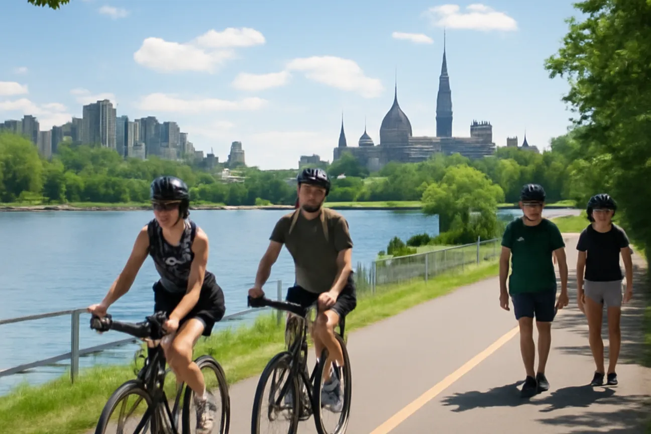
Ottawa’s core remains compact enough for walking to serve as the primary means of movement for most visitors. From the steps of Parliament Hill, the distance to the ByWard Market is roughly one kilometre along Wellington Street and Sussex Drive, a route that takes fifteen to twenty minutes on foot depending on traffic signals. Sidewalks are continuous and kept clear of snow through the winter months by municipal crews, though surfaces can become icy after an overnight freeze. The Rideau Canal pathway offers a parallel route east of the downtown core, running from around Carleton University north to the Ottawa River, with benches placed at regular intervals and pathway lighting in place for evening use during the warmer months.
Cycling infrastructure consists of the Capital Pathway network administered by the National Capital Commission. The section that follows the Ottawa River from the Alexandra Bridge toward Britannia Beach is separated from motor traffic for most of its length. Bicycle rentals are available from racks operated by the city’s public system at locations including the Rideau Centre and the Canadian Museum of History. Helmets are not mandatory for adults, yet the city recommends them; dedicated bike lanes on Laurier Avenue and Albert Street carry riders through the business district, though actual speeds vary with traffic and pathway conditions. Visitors should note that pathways are shared with pedestrians and that bells or verbal warnings are expected when overtaking.
Street crossings at major intersections such as Bank and Sparks are equipped with countdown timers and audible signals. During the winter festival period in February, temporary closures can reroute cyclists onto adjacent roads. Central routes are generally flat to gently graded, which keeps exertion moderate even for occasional riders.
Taxis and ride-shares
Licensed taxis display a roof light and a municipal plate issued by the City of Ottawa. The principal companies maintain stands at the Ottawa Macdonald-Cartier International Airport, where some operators offer a flat fare to destinations inside the urban core while others run on the meter; it is worth asking the dispatcher or driver which applies before setting off, and checking the current tariff structure with the taxi company or the City of Ottawa, since rates are periodically revised. Receipts are provided on request and include the driver’s licence number.
Ride-share services operate under the same municipal by-law as taxis. Vehicles are summoned through applications that display estimated arrival times and fixed quotes before confirmation. Surge pricing occurs during weekday morning and evening peaks, occasionally raising the airport-to-downtown fare above the taxi rate. Pick-up zones at the airport are located on the arrivals level, while downtown requests are fulfilled at the curb on one-way streets such as Metcalfe and O’Connor. Passengers travelling with luggage are advised to select the larger-vehicle option, as standard sedans accommodate two large suitcases plus carry-on items.
Service reliability varies by time of day. On weekday evenings, wait times for either taxis or ride-shares tend to run a little longer within the central business district as demand picks up. During winter storms, both fleets experience reduced availability; advance booking through a company dispatch line is then advisable. Tipping remains discretionary, following the same general convention as other personal transport services in Canada. Visitors weighing a downtown hotel against a stay further out should consult our where to stay in Ottawa guide, since fare costs and wait times both factor into that choice.
Many visitors find that walking covers most short downtown trips comfortably, saving taxis and ride-shares for heavier luggage days or longer crossings — the compact, walkable core rewards either choice if a little extra time is built into the schedule.
Driving and parking
Visitors who arrive by private vehicle encounter a grid of one-way streets in the downtown core that channels traffic onto Laurier Avenue, Albert Street, and King Edward Avenue. The Queensway (Highway 417) provides the principal east-west corridor, with exits at Metcalfe Street and Bronson Avenue serving the parliamentary precinct. Rush-hour restrictions prohibit stopping on these arterials between 07:00–09:30 and 15:30–18:00 on weekdays. Fuel stations within the city limits are spaced approximately three kilometres apart on Bank Street and Montreal Road.
Public parking garages operated by the Ottawa Parking Authority offer the most predictable option near major attractions, including a large garage at the Rideau Centre and surface lots along the canal. Rates and capacity vary by location and are updated periodically, so it is best to check current daily and hourly rates on the Ottawa Parking Authority’s website before arriving. On-street metered parking accepts coins, credit cards, and the city’s mobile application; rates vary by zone, with time limits enforced during business hours in most downtown areas. Overnight parking on residential streets requires a permit displayed on the dashboard; visitors without permits should plan on a garage for overnight stays.
Winter conditions introduce additional constraints. Snow-removal operations clear major routes overnight, requiring vehicles to be moved from posted streets during designated hours — check posted signage, as these windows can change. Some parking garages have height restrictions for larger vehicles, so drivers of vans or SUVs should confirm clearance before entering. Electric-vehicle charging is available at a number of downtown garages and museum parking areas; visitors should check the operator’s website or an EV charging app for current locations and connector types.
For low-impact travel between cities in the wider region, the French-language network verygreentrip.com keeps a complementary inventory of rail and bus routes that pair well with Ottawa’s public transit. Travellers planning multi-stop itineraries across Ontario and Quebec often consult both before committing to an itinerary.
A short checklist for first-time visitors deciding how to get around:
- Staying downtown for 3 days or fewer: walk and use the Confederation Line — skip the rental car
- Crossing to Gatineau more than once: buy an STO ticket separately, since Presto value does not transfer
- Arriving by air: Route 97 is the cheapest airport link; a taxi is the fastest option for groups with luggage
- Visiting in winter: budget extra transfer time, since surface routes slow during snow removal
- Cycling the Capital Pathway: check NCC Bikedays dates if visiting on a summer weekend, when some parkways close to cars
Things to do in Ottawa often begin with a walk along the canal before visitors decide whether to continue on foot or transfer to another mode for longer distances. The same considerations apply when planning day trips from Ottawa, where parking at trailheads remains free yet limited in number.
The choice of transport shapes the pace at which the city reveals itself. Walking and cycling place the visitor at street level among the stone façades and canal reflections, while taxis and ride-shares compress distances during inclement weather. Driving reserves flexibility for outlying sites yet requires attention to seasonal regulations and parking availability. Each option remains viable within the same compact geography, allowing travellers to adjust daily according to weather, luggage, and schedule without sacrificing access to the parliamentary grounds, markets, or museum district.
Frequently asked
Ottawa's main public transit system is operated by OC Transpo, which includes buses and the O-Train light rail. Visitors can purchase single-ride tickets, day passes, or use a Presto card for convenient travel across the city. Routes connect key attractions, downtown, and major hubs, with service running from early morning until late evening.
The most direct option is OC Transpo Route 97, which runs frequently from the airport to downtown stations. Taxis and rideshare services like Uber are available at the arrivals area and typically take 20-30 minutes depending on traffic. Pre-booking a shuttle or renting a car are additional choices for those with specific needs.
Many central areas, including Parliament Hill, ByWard Market, and the Rideau Canal, are compact and pedestrian-friendly with sidewalks and pathways. The city maintains extensive bike paths and offers bike-share programs such as VeloGo for short-term rentals. Visitors should check weather conditions, especially in winter when sidewalks may be icy.
Licensed taxis can be hailed at stands or booked by phone, while Uber and Lyft operate throughout the city with standard app-based booking. Fares are metered or estimated in advance, and drivers are required to follow local regulations. It is advisable to use official services to ensure safety and fair pricing.
Downtown offers paid street parking, municipal lots, and garages, with rates varying by location and time of day. Many attractions provide on-site or nearby parking, though spaces can fill quickly during peak seasons. Drivers should note restrictions, winter parking rules, and consider transit to avoid congestion.