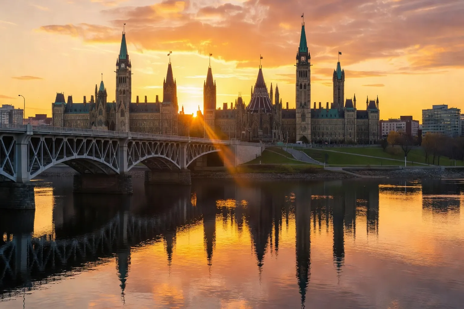
Ottawa’s compact urban core sits at the confluence of the Ottawa River and the Rideau Canal, creating layered sightlines that change dramatically with the angle of the sun and the tilt of the seasons. Limestone façades, steel truss bridges, and the flat water surface of the canal reflect light in ways that reward photographers who arrive before crowds and stay through golden hour. The city’s modest elevation changes and the nearby Gatineau hills provide both intimate foregrounds and sweeping backdrops without requiring long drives. The Rideau Canal, completed in 1832 as a military supply route between Ottawa and Kingston, remains a working waterway whose stepped locks still influence how reflections form on its surface during long-exposure shots. Photographers often notice that the canal’s limestone walls retain a texture that catches sidelight particularly well after rainfall. More on the canal’s history and engineering appears in the Rideau Canal UNESCO heritage guide, which explains why certain lock alignments continue to produce mirror-like surfaces under specific wind conditions.
Why Ottawa rewards photographers in every season
Four distinct seasons alter the color temperature, contrast, and texture of every viewpoint. In winter the limestone of Parliament turns a cool blue-gray under overcast skies while the frozen canal supplies a white leading line. Spring brings high-contrast raking light through still-bare trees and mist rising from the locks. Summer foliage deepens shadows but the long days allow dawn and dusk shoots separated by only six hours. Fall introduces saturated reds and oranges that complement the warm stone. Because the river valley runs roughly east-west, morning light strikes the south-facing façades of major buildings while afternoon light models the north side of the Alexandra Bridge towers.
Travelers who combine photography with slower movement patterns often discover additional micro-locations simply by walking the same route at different times of day. scenic travel photography across Canada shows how similar river-valley geometries appear across the country, helping visitors recognize why Ottawa’s scale feels manageable on foot. Local photographers who return to the junction of the canal and the river across different mornings often notice how temperature inversions can create a thin layer of fog that softens the bridge towers while leaving the Parliament spires sharply defined. The same location in July yields completely different results when humidity rises and the water surface begins to mirror the sky’s deeper blue. On damp spring mornings, dew on the limestone can noticeably increase specular highlights when the sun angle stays low, an effect worth watching for after a wet night.
Parliament Hill at sunrise: the classic capital shot
The south façade of the Centre Block and the Peace Tower catch the first direct light around 5:45 a.m. in mid-June and 7:30 a.m. in mid-December. Arriving thirty minutes earlier places the sun low enough to skim across the Ottawa River and produce a mirror reflection when the water is calm. Tripod legs fit between the granite bollards on the Wellington Street sidewalk directly opposite the main gates; this spot keeps the entire 170-metre length of the building in frame with a 35 mm lens on a full-frame body.
Few tourists appear before 8 a.m., so the foreground remains clear of people. The limestone reflects a warm peach tone only during the first fifteen minutes after the sun clears the horizon; after that the light becomes harsher and the contrast drops. Photographers who return on successive mornings can compare the effect of clear versus high-cloud conditions, the latter producing softer shadows on the Gothic detailing. High cirrus cloud tends to produce the most even illumination across the height of the Peace Tower, while a 24 mm tilt-shift lens can correct the slight keystoning caused by shooting from street level. On mornings with a thin, even cloud layer, the diffused light acts as a natural soft-box, reducing the dynamic range enough to allow single-exposure captures without graduated ND filters.
The Rideau Canal locks and ByWard Market backdrop
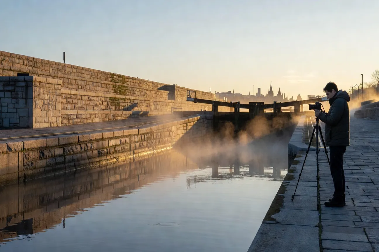
Eight locks step the canal down 24 metres from the Ottawa River to the lower basin. The stone walls and black iron gates create repeating geometric lines that lead the eye toward the copper-roofed market buildings beyond. The best angle sits on the western lock wall at the level of the third gate, looking northeast; a 24 mm lens captures both the water drop and the market spire.
Morning light from the southeast skims the wet stone after a lock cycle, adding specular highlights. Evening light from the opposite direction models the lock-keeper’s cabin and the red brick façades. Because the site is a working lock station, gates open and close on a published schedule; checking the current timetable with Parks Canada before a visit prevents shots interrupted by sudden water turbulence. The same location appears in the Rideau Canal UNESCO heritage guide, which documents the 1832 engineering that still governs water levels today. A release of water from the upper basin during a lock cycle can briefly create turbulent surface texture that adds dynamic interest to an otherwise static composition, and photographers who time their arrival with the first lock cycle of the day often catch the moment the iron gates swing open and release a plume of mist across the frame. In the calm interval right after a lock closes, the water can settle into a glassy stillness that suits long-exposure work — worth watching for regardless of the exact time of day.
Alexandra Bridge: the skyline shot toward Parliament
The steel truss of the Alexandra Bridge provides an elevated platform 15 metres above the river. Walking to the midpoint on the downstream pedestrian walkway frames the full Parliament skyline between the bridge cables. A 50 mm lens produces a natural perspective without converging verticals.
The bridge runs north-south, so sunrise light arrives from the east and side-lights the limestone while sunset places the sun behind the viewer and evenly illuminates the façades. Wind across the open structure can blur long exposures; a monopod braced against the railing stabilizes the camera more effectively than a tripod in gusty conditions. The view changes character after dark when the Peace Tower illumination shifts from warm white to cooler LED tones later in the evening. On windy days, gusts on the exposed bridge deck can force exposure times down significantly even with image stabilization engaged, so checking the wind forecast beforehand is worthwhile. The steel cables themselves create leading lines that converge toward the Parliament buildings when shot at longer focal lengths, adding depth that a wider lens flattens. On sunny afternoons, the bridge’s railings can cast a repeating shadow pattern on the walkway deck, which can be used as a natural foreground grid when composing vertical frames.
Major’s Hill Park and its river views
Major’s Hill Park occupies the bluff immediately east of the Château Laurier. A gravel path along the eastern edge drops 12 metres to a narrow terrace that places the viewer level with the tops of the lock gates. From this terrace a 70 mm lens isolates the Château’s copper roof against the Ottawa River and the Gatineau hills.
Because the park sits above the river, it offers a clear sightline even when low river mist obscures lower viewpoints. Late-afternoon light from the west strikes the Château’s east façade and turns the copper a deep verdigris. Check the National Capital Commission’s current posted hours before a visit, since park closing times can vary by season, and plan night sessions around the last streetlamps on Sussex Drive switching off. The elevated terrace tends to hold direct sunlight noticeably longer than the lower lock level around the equinoxes, giving photographers an extended window for warm-toned architecture shots. The elevation change also alters both exposure values and the color temperature of reflected light from the river surface compared with shooting at canal level, a nuance worth accounting for when setting white-balance presets on mirrorless bodies.
The Gatineau lookout: panoramic views across the valley
The lookout platform on the Quebec side sits 120 metres above the river on the edge of Gatineau Park. A 24 mm lens on a full-frame sensor records the entire Ottawa skyline from the Canadian Museum of History to the Rideau Falls. The elevated position compresses the river into a horizontal band that separates foreground foliage from the distant city.
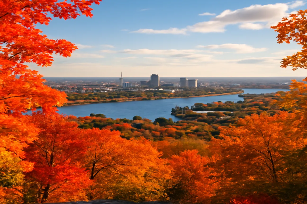
The platform faces almost due south, so sunrise light crosses the valley and side-lights the Parliament buildings while sunset places warm light on the Gatineau hills behind the photographer. Access requires the parkway road; check the National Capital Commission’s current seasonal gate hours before planning an early start. Gatineau Park across the seasons details how snow depth and leaf cover affect foreground color at this exact elevation. After a heavy snowfall, the lookout elevation can carry a deep foreground of unbroken white that visually simplifies the frame and makes wide-angle compositions of the Ottawa skyline feel more expansive. Wind often sculpts fresh snow into wave patterns that add texture without requiring additional foreground elements, and a light crust forming on the snow surface after a freeze-thaw cycle can produce specular reflections that call for a reduction in exposure compensation.
Winter photography: the frozen Rideau Canal Skateway
Once the canal freezes to 30 cm thickness, usually by mid-January, the 7.8 km Skateway opens to skaters and walkers. The flat ice surface supplies an unbroken leading line that terminates at the Château Laurier. Photographers on the ice need crampons or ice cleats; a fall on the hard surface can damage both equipment and the photographer.
The best winter light arrives between 9 a.m. and 11 a.m. when the sun angle is still low but the sky has lost its deep blue pre-dawn cast. the Rideau Canal Skateway operator interview explains how ice thickness is measured daily and the decision to open or close the Skateway is posted each morning. During a hard cold snap, the canal can build up enough clear ice to let photographers set up tripods directly on the surface once the Skateway is officially open, though ice cleats and caution around posted safety notices remain essential. A long exposure on the ice can render the distant Château as a sharp silhouette against the pale winter sky while the ice itself shows subtle crystalline patterns left by the previous day’s skaters. Surface hoar frost forming overnight can noticeably increase the ice’s reflectance, which may call for a corresponding adjustment in shutter speed when shooting at slower exposures.
Fall foliage photography spots near the city
Peak color in the Ottawa valley occurs between 5 and 15 October. The Rideau Falls viewpoint on the Ontario side and the Gatineau Hills above the Chelsea Lookout both place red and orange maples against the gray river. A circular polarizer reduces glare on the wet leaves after morning dew, increasing color saturation by roughly one stop.
Because the valley runs east-west, north-facing slopes retain color one week longer than south-facing slopes. Photographers who shoot the same composition on successive weekends can document the progression from green through scarlet to bare branches. A prolonged mild spell in fall can extend peak color by several days, opening up multiple sessions at the same maple stands near the Chelsea Lookout. Using a telephoto lens to isolate individual trees against the darker river background reveals how the anthocyanin pigments in sugar maples shift from orange to deep crimson as nighttime temperatures drop. Most stands hold their leaves until the first sustained hard frost, giving photographers a narrow but fairly predictable window for maximum color density each year.
Practical gear and timing tips for each season
| Season | Recommended focal lengths | Filter | Tripod notes | Light window |
|---|---|---|---|---|
| Winter | 24-70 mm, 70-200 mm | UV, polarizer | Short legs for ice stability | 08:30-10:30 |
| Spring | 16-35 mm, 35 mm | ND 6-stop for lock water | Full height on grass | 05:45-07:15 |
| Summer | 24 mm, 50 mm | Polarizer | Avoid metal feet on hot stone | 05:00-06:30 & 20:00-21:30 |
| Fall | 24-70 mm | Polarizer, 3-stop ND | Weighted for wind | 06:30-08:00 & 17:30-19:00 |
A lightweight rain cover protects against sudden river mist in every season. Spare batteries should be kept inside a jacket pocket because cold significantly reduces lithium battery capacity, and keeping batteries close to body temperature helps preserve much more of their nominal capacity during long winter shoots.
Beyond the seasonal focal-length table, a compact kit that covers all five viewpoints without a lens change at every stop looks like this:
- A 24-70 mm zoom for the Parliament Hill sunrise shot and the Rideau Canal locks
- A 70-200 mm telephoto for isolating the Château Laurier roofline from Major’s Hill Park
- A polarizing filter to cut glare on wet stone and canal water after rain or a lock cycle
- A sturdy travel tripod rated for wind gusts above 25 km/h on the Alexandra Bridge deck
- A monopod as a lighter backup when wind rules out a full tripod on exposed structures
- Ice cleats or crampons for any shoot on the frozen Skateway surface in January and February
Each Ottawa viewpoint also rewards a slightly different arrival window relative to sunrise or sunset, which the table below summarizes alongside the walking distance from the ByWard Market as a central reference point.
| Viewpoint | Best relative arrival | Distance from ByWard Market |
|---|---|---|
| Parliament Hill (Wellington St.) | 30 min before sunrise | 10-minute walk |
| Rideau Canal locks | First lock cycle of the day | 5-minute walk |
| Alexandra Bridge midpoint | 20 min before sunrise or after sunset | 12-minute walk |
| Major’s Hill Park terrace | Late afternoon | 8-minute walk |
| Gatineau lookout | Midday for panoramas, dusk for city lights | 25-minute drive or bus |
Tip: Arrive at each location thirty minutes before the calculated sunrise or sunset time listed in a local ephemeris app; this buffer accounts for the difference between astronomical and civil twilight on the valley floor.
A photographer’s one-day route through Ottawa
Begin at the Alexandra Bridge at 05:15 for the pre-dawn skyline. Walk east along Sussex Drive to Major’s Hill Park by 06:45 for the Château terrace shot. Continue south to the Rideau locks by 07:30 when the first lock cycle begins. After breakfast in the ByWard Market, take the 11:00 bus across the river to the Gatineau lookout for midday panoramas. Return to Ottawa by 15:00 and finish at Parliament Hill for the 17:45 sunset. The entire loop covers 9 km on foot plus one short bus ride, leaving time for weather delays.
Checklist: Confirm lock schedule, check park gate times, pack both wide and normal primes, carry two batteries per body, and file a float plan with a contact person before crossing the bridge on foot in winter.
The same route can be compressed or expanded depending on season and daylight length. top must-see Ottawa attractions lists additional foreground subjects that fit between the core viewpoints without adding significant walking distance. sustainable and slow travel planning emphasizes that walking this circuit rather than driving reduces both carbon impact and the chance of missing transitional light between locations. Photographers who have followed this route report that the total walking time runs to roughly three hours once brief stops for composition adjustments are included, which keeps the loop practical even on shorter fall days.
Frequently asked
Sunrise offers the softest light on the limestone facade and fewer crowds, while sunset provides warm golden tones on the Peace Tower, both preferable to the flatter light of midday.
The Alexandra Bridge, connecting Ottawa to Gatineau, offers one of the most recognizable skyline views with Parliament Hill and the Rideau Canal locks in the same frame.
Yes, the elevated viewpoint in Gatineau Park offers a wide panoramic view of Ottawa and the river valley, particularly striking during fall foliage season.
The frozen Rideau Canal Skateway with skaters against the Parliament Hill backdrop is one of Ottawa's most distinctive winter photography subjects, especially at dusk when the ice is lit.
No permit is required for casual photography from public grounds around Parliament Hill, though tripod use in some areas during peak tourist season may require additional courtesy toward other visitors.