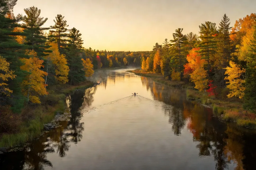
Ottawa’s reputation as an outdoor city rests, more often than not, on a single postcard: the maple canopy of Gatineau Park in October, or skaters gliding down the frozen canal in January. Both are earned reputations. But they are also a kind of shorthand that flattens a region whose outdoor range is considerably wider than its two most photographed assets. Follow the Ottawa River upstream or downstream from the downtown core, and the geography opens into whitewater rapids, quiet conservation forests, backcountry-adjacent campgrounds, and cross-country ski networks that rarely appear in a weekend itinerary. This is a guide to that wider footprint — the paddling, hiking, camping, and winter terrain that sits just beyond the park everyone already knows.
Why Ottawa’s outdoor scene extends past Gatineau Park
Gatineau Park earns its fame honestly. It is close, it is vast, and its lookouts photograph beautifully in every season. But treating it as the region’s only outdoor destination misses the point of the Ottawa Valley’s actual geography: the capital sits at the confluence of three rivers, ringed by conservation authorities that manage a patchwork of forests, wetlands, and escarpments largely independent of the National Capital Commission’s flagship park.
The practical result is that a visitor with a car and a free day has meaningfully more terrain to choose from than the park’s trail map suggests. Paddling on the Ottawa River draws from a completely different set of access points than anything inside Gatineau Park’s boundaries. Hiking through the Marlborough Forest or the Foley Mountain Conservation Area involves different soil, different elevation, and a different crowd than the Champlain Lookout parking lot on a Saturday in October. Camping an hour outside the city, whether at a provincial park or a conservation authority campground, offers an overnight option that Gatineau Park’s day-use focus does not really provide.
There is also a seasonal argument for looking beyond the park. Gatineau Park’s trail network gets genuinely crowded during peak leaf season and on the first sunny weekends of spring. The alternative destinations covered here tend to absorb visitor traffic more comfortably, if only because fewer people know to look for them. None of this is a case against Gatineau Park — see the fall foliage season in Gatineau Park for that side of the story — but a case for treating the region’s outdoor identity as considerably larger than one park’s boundary line.
Best season: Early June through mid-October covers paddling, hiking, and camping at their most reliable; December through March belongs to snowshoeing and cross-country skiing once consistent snow cover arrives.
A short list of what distinguishes the region beyond the park:
- A major river system with both flatwater and whitewater sections within a 30 to 90 minute drive of downtown
- Multiple conservation authorities (South Nation, Rideau Valley, Mississippi Valley) each maintaining independent trail and camping infrastructure
- Provincial park camping within an hour’s drive, rare for a city of Ottawa’s size
- A well-developed network of outfitters used to renting gear to visitors without their own equipment
Kayaking and canoeing the Ottawa River
The Ottawa River is, geologically speaking, the region’s defining feature, and it offers a paddling range broad enough to suit a first-timer in a rental kayak and a whitewater veteran in the same afternoon. The river’s character changes dramatically depending on where you put in, which is the first thing to understand before choosing a launch point.
Closer to the city, the river runs wide and comparatively calm, particularly around Britannia Bay and the stretch near Shirleys Bay, where the current slows and the shoreline flattens into marsh and parkland. These sections suit beginners, families, and anyone who wants a paddling afternoon without technical risk. Rental operators along this stretch cater specifically to that market, with tandem kayaks and stable recreational canoes available by the hour.
Further west, toward the Ottawa Valley proper, the river’s personality shifts. Near the towns along the Quebec side upstream of the capital, several sections deliver genuine whitewater, with rapids that draw rafting companies and experienced kayakers from well outside the region. This is not a beginner’s stretch of river; outfitters here typically require guided trips or proof of whitewater experience before renting equipment independently.
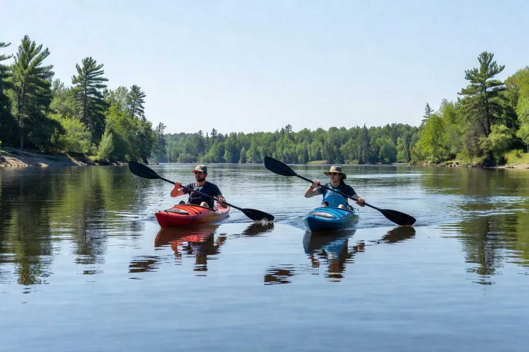
Between these two extremes sits a middle tier of moving water, fast enough to feel like a river rather than a lake but manageable for an intermediate paddler with some current experience. Several put-in points along this middle stretch are maintained by municipal parks departments and are marked with basic signage, though facilities are minimal compared to the more developed access points closer to downtown.
Rather than pretend to a false precision about mileage that shifts with water levels, the more useful way to compare launch points is by paddler experience level and typical trip length:
| Launch area | Water character | Best suited to | Typical trip length |
|---|---|---|---|
| Britannia Bay / Shirleys Bay | Flat, slow current | Beginners, families | 1–2 hours |
| Mid-river municipal access points | Moving water, mild current | Intermediate paddlers | 2–4 hours |
| Ottawa Valley whitewater sections | Rapids, technical | Experienced or guided paddlers | Half-day to full-day |
Safety note: Water temperatures on the Ottawa River remain cold well into June, and current strength can be deceptive even in sections that look calm from shore. A personal flotation device is non-negotiable, and first-time paddlers on unfamiliar stretches should stick to guided outings or well-marked municipal launch points.
Timing matters as much as location. Spring paddling coincides with higher water levels and faster current, which intensifies the whitewater sections but can make flatwater stretches choppier than expected. By midsummer, water levels typically drop and the river settles into its most predictable rhythm, which is also when rental demand peaks. Early autumn offers a quieter version of the same conditions, with the added appeal of shoreline colour beginning to turn before the crowds associated with the fall foliage season in Gatineau Park arrive in force elsewhere in the region.
Hiking trails in nearby conservation areas
Ottawa’s hiking options outside Gatineau Park are administered by a patchwork of conservation authorities, each with its own trail standards, signage, and personality. The result is less a single unified network than a series of distinct, smaller destinations, each worth visiting for a different reason.
The Marlborough Forest, managed jointly by conservation authorities south of the city, offers one of the largest contiguous forest blocks in the region, with trails that range from short interpretive loops to longer routes through wetland and mixed hardwood terrain. It draws a fraction of Gatineau Park’s foot traffic, which makes it a reliable choice for anyone hoping to hike without sharing the trail every few minutes.
Foley Mountain Conservation Area, roughly an hour southwest of the city near Westport, trades forest density for elevation and lookout views over the Rideau Lakes system. Its main lookout trail is short enough for a casual visitor but rewards the climb with a panorama that rivals anything inside Gatineau Park’s boundary, without the parking congestion.
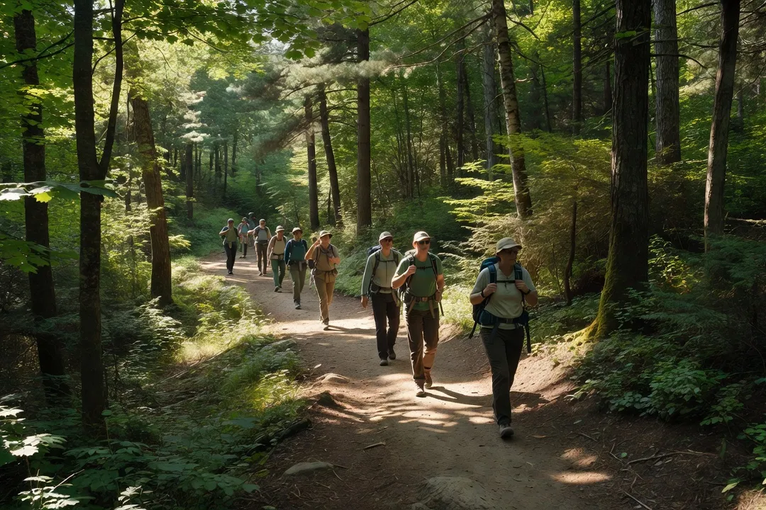
Closer to the city, several smaller conservation areas along the Rideau and Mississippi valleys maintain shorter loop trails suited to a half-day outing rather than a full day trip. These are less destinations in their own right than convenient additions to a broader plan — worth combining, for instance, with our guide to day trips from Ottawa if the goal is to see more than one place in a single outing.
A rough comparison of the main options, organized by distance and difficulty rather than by name recognition:
| Trail area | Distance from downtown | Difficulty | Best season |
|---|---|---|---|
| Marlborough Forest trails | 45–60 min | Easy to moderate | Late spring to fall |
| Foley Mountain Conservation Area | 60 min | Moderate (short climb) | Spring through fall |
| Rideau Valley conservation loops | 20–40 min | Easy | Year-round |
| Mississippi Valley trail network | 40–50 min | Easy to moderate | Spring through fall |
Practical notes worth keeping in mind before setting out:
- Conservation authority trails are generally less signed than provincial park trails; downloading an offline map before arriving is worth the extra step.
- Parking at smaller conservation areas is limited and sometimes informal — arriving before mid-morning on weekends avoids the worst of it.
- Cell coverage drops out in several of the more forested sections, particularly in the Marlborough Forest interior.
- Many of these areas charge a modest day-use fee at self-serve kiosks; carrying small bills is a minor but recurring necessity.
The appeal of these trails is cumulative rather than singular. No one conservation area matches Gatineau Park’s scale, but taken together, they offer a hiking season that runs longer, feels less crowded, and covers a wider range of terrain than the park alone.
Camping options within an hour of the city
Overnight camping within realistic driving distance of downtown Ottawa is more available than most visitors assume, spread across a mix of provincial parks, conservation authority campgrounds, and private operations.
Fitzroy Provincial Park, roughly 45 minutes west of the city along the Ottawa River, is the closest true provincial park camping option and offers both serviced and unserviced sites in a riverside setting. Its proximity makes it a reasonable choice for a first overnight camping trip without committing to a long drive, and its riverfront location connects naturally with the paddling routes described above.
Further afield, several conservation authority campgrounds along the Rideau and Mississippi valleys offer a quieter, more basic alternative, generally with fewer amenities than a provincial park but correspondingly fewer crowds and lower fees. These sites tend to book up more slowly than the provincial park system, which makes them a reasonable fallback for visitors planning a trip on short notice.
Safety note: Campground availability tightens considerably during peak summer weekends and the fall foliage weeks that overlap with Gatineau Park’s busiest period; reserving at least two to three weeks in advance is advisable for anything within an hour of the city.
A short breakdown of the main choices:
- Fitzroy Provincial Park — riverside setting, serviced and unserviced sites, closest true provincial park option
- Rideau Valley conservation campgrounds — basic amenities, lower fees, better late-notice availability
- Mississippi Valley campgrounds — similar profile, slightly further west, quieter on weekdays
- Private campgrounds near the Ottawa Valley — more amenities (showers, small stores), priced accordingly higher
For visitors without their own camping gear, several outfitters mentioned later in this guide also rent basic tent and sleeping equipment, which removes one of the larger barriers to a first overnight trip in the region.
Winter outdoor activities beyond canal skating
The Rideau Canal Skateway understandably dominates Ottawa’s winter identity, but the region’s conservation areas and forest trails support a winter outdoor season that runs longer and covers considerably more ground than the canal alone.
Snowshoeing is the most accessible entry point. Several conservation areas that serve as summer hiking destinations groom or at least maintain their trails for snowshoe use through the winter months, often renting equipment on-site or nearby for visitors without their own. The appeal here is largely about quiet: winter foot traffic on these trails is a fraction of summer levels, and a forest under snow cover has a stillness that the same trail lacks in July.
Cross-country skiing draws a more dedicated following, with groomed trail networks maintained by both conservation authorities and private ski clubs scattered through the valley. Trail quality varies considerably depending on snowfall in a given winter, and it is worth checking conditions directly with a trail operator before planning a dedicated ski day, since a thin snow year can close trails that were reliable the winter before.
A quick comparison of the two main winter activities:
| Activity | Equipment needed | Skill level | Where to go |
|---|---|---|---|
| Snowshoeing | Snowshoes, poles (optional) | Beginner-friendly | Most conservation area trails |
| Cross-country skiing | Skis, boots, poles | Beginner to advanced, trail-dependent | Dedicated groomed networks |
Beyond these two staples, several operators in the region run guided winter outings, including moonlight snowshoe walks and beginner ski lessons, both of which suit visitors who want structure rather than a self-guided outing. For a completely different kind of winter perspective on the valley, hot air balloon rides over the Ottawa Valley occasionally operate in winter conditions when weather permits, offering an aerial view of the same landscape that snowshoers experience at ground level.
Gear rentals and outfitters for visitors without equipment
A recurring theme across paddling, hiking, and winter activities is that a lack of personal gear is rarely a real barrier in this region. A cluster of outfitters, most concentrated near the river and along the main routes into the Ottawa Valley, rent everything from kayaks to snowshoes on a daily or hourly basis.
Paddling equipment is the most widely available rental category, reflecting the river’s central role in the region’s outdoor identity. Operators near Britannia Bay and other calmer stretches typically rent kayaks, canoes, and increasingly, stand-up paddleboards, usually with a simple safety briefing included in the rental price. Whitewater rental is more limited and generally bundled with guided trips rather than offered as independent equipment rental, given the skill required.
Hiking gear rental is less common as a standalone category, since most visitors arrive with adequate footwear and layers, but several outdoor retailers in the city rent trekking poles, larger backpacks for overnight trips, and occasionally bear-safety equipment for the more remote conservation areas.
| Gear category | Typical rental location | Advance booking needed |
|---|---|---|
| Kayaks / canoes | River-adjacent outfitters near Britannia Bay | Recommended on summer weekends |
| Stand-up paddleboards | Same operators as kayak rental | Recommended on summer weekends |
| Camping equipment (tents, sleeping bags) | Outdoor retailers in the city | Yes, especially peak season |
| Snowshoes | Conservation area visitor centres, outdoor retailers | Usually available same-day |
| Cross-country skis | Ski clubs, dedicated trail operators | Recommended for weekend visits |
A short set of practical notes on renting rather than buying:
- Reserving ahead is far more important for river gear on summer weekends than for winter equipment, where same-day availability is usually reliable.
- Most outfitters near the river operate seasonally, typically from late spring through early fall, so checking operating dates before planning a trip is worth the extra step.
- Bundled packages, particularly for guided whitewater trips, often work out cheaper than renting equipment and figuring out logistics independently.
For readers exploring the region without a personal vehicle, getting around the region without a rental car is worth reading before booking, since several of the outfitters described here sit outside the reach of downtown transit and require either a rental car or a shuttle arranged directly through the operator.
Planning a full outdoor day trip from downtown
Assembling all of this into a single day trip is less complicated than the range of options above might suggest, provided the plan accounts for driving time honestly rather than optimistically. A single day realistically supports one primary activity, plus a secondary stop, rather than an ambitious combination of paddling, hiking, and a lookout drive all in one outing.
A paddling-focused day works well built around a late morning launch, giving water levels and any overnight fog time to clear, followed by a late lunch at one of the small towns along the river before the drive back into the city. A hiking-focused day benefits from an earlier start, particularly at the more popular conservation areas, where parking fills quickly on weekends.
For visitors weighing several of these destinations against each other, a simple framework helps:
- If the priority is paddling, build the day around a single launch point and resist the temptation to drive between multiple river access areas.
- If the priority is hiking, pick one conservation area rather than attempting two, since driving between them consumes more of the day than the trails themselves.
- If camping is part of the plan, treat travel day as arrival day only, and save the actual outdoor activity for a full second day at the site.
- If gear rental is required, confirm operating hours and reservation policy before finalizing the rest of the itinerary, since rental logistics are often the actual constraint on timing.
None of these outings require abandoning the region’s more famous attractions entirely. A paddling morning on the river pairs naturally with an afternoon drive through the fall foliage season in Gatineau Park during the right weeks of autumn, and a hiking day in one of the smaller conservation areas fits comfortably alongside other stops from our guide to day trips from Ottawa. The point of looking beyond Gatineau Park is not to replace it, but to recognize that the capital’s outdoor range extends considerably further than its most photographed corner suggests — a fact borne out by resources on responsible outdoor travel across Canada and nature-focused itineraries in the region, both of which treat the Ottawa Valley as one stop among many rather than a single-park destination.
Whatever the season, the wider region rewards the same instinct that makes Gatineau Park worth visiting in the first place: a willingness to drive an hour, find a quieter trailhead or launch point, and let the Ottawa Valley’s actual geography — rivers, escarpments, forest blocks, and lake country — do the rest of the work.
Frequently asked
The Ottawa River offers several put-in points for paddling, with calmer sections suited to beginners and whitewater sections near the Ottawa Valley for more experienced paddlers seeking rapids.
Yes, several conservation areas and provincial parks within an hour's drive offer marked trails ranging from easy loop walks to more demanding day hikes.
Several campgrounds and conservation areas within roughly an hour of the city offer both tent and RV camping, making an overnight outdoor trip feasible without a long drive.
Snowshoeing and cross-country skiing trails are widely available in the region's conservation areas, complementing the more famous Rideau Canal Skateway experience downtown.
Several outfitters near the river rent kayaks, canoes, and paddleboards, so visitors without their own equipment can still enjoy a paddling day trip.